Choosing where to rent in Boston is one of the most consequential decisions a person can make, and yet most renters rely on word of mouth, gut feelings, or outdated online forums to guide that choice. In 2026, there is a better way. The Boston Police Department publishes detailed crime incident data broken down by district, offense type, and reporting period, giving renters access to the same objective information that researchers, city planners, and real estate analysts use every day. At Homzora Realty, we believe renters deserve a clear, honest, data driven picture of every neighborhood before they sign a lease. This article walks through the BPD crime statistics district by district, explains what those numbers actually mean in practical terms, and shows you how to use the data to make a smarter, safer housing decision in 2026.
Why Crime Data Matters More Than Neighborhood Reputation
Reputation is a lagging indicator. A neighborhood that was considered rough ten years ago may have transformed significantly, while a neighborhood with a polished image may carry hidden risks that casual observation simply cannot reveal. Crime statistics from the Boston Police Department are a leading indicator because they reflect actual reported incidents in recent periods, not impressions formed years or decades ago.
Boston Renter Intelligence Survey
You are exactly who this is for.
We are building Boston's first independent renter intelligence report from real tenant data, not listing-site estimates. Add your numbers and get the Q3 report free when it publishes October 7.
Take the 2-minute survey →The BPD organizes its reporting around 11 geographic districts, each covering multiple neighborhoods and identified by an alphanumeric code. These districts form the backbone of the department’s public data releases, which are updated regularly and made available through the City of Boston’s open data portal. For renters, the most useful metrics include total incident volume, offense category breakdowns, time of day patterns, and year over year trends. Each of those metrics tells a different story, and reading them together gives you a genuinely three dimensional view of safety in any given area.
Before diving into the district level data, it is worth understanding one foundational concept. Crime rate, not raw crime count, is the appropriate comparison tool. A district with 10,000 residents and 200 incidents has a meaningfully different profile than a district with 80,000 residents and the same 200 incidents. Population adjusted rates allow fair comparisons across areas of very different sizes, and that is the standard we apply throughout this analysis.
BPD District Overview and What the Numbers Reveal
Boston’s 11 police districts cover the entire city and overlap with dozens of distinct neighborhoods. The districts most relevant to renters searching for apartments in 2026 are A1, A7, B2, B3, C6, C11, D4, D14, E5, E13, and E18. Each has a distinct crime profile shaped by population density, commercial activity, housing type, and socioeconomic factors.
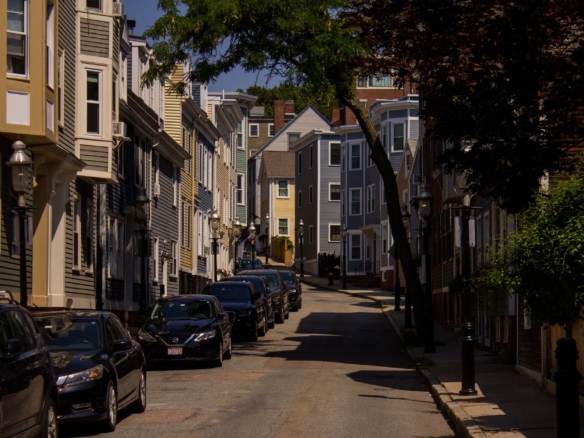
District A1 Downtown and Beacon Hill
District A1 covers Downtown Boston, Beacon Hill, the North End, and the Waterfront. This district consistently records a high volume of property crimes, particularly larceny and motor vehicle theft, driven largely by the density of commercial activity, tourist foot traffic, and parking infrastructure. Violent crime rates in A1 are comparatively lower relative to population, though the absolute number of incidents can appear alarming without context.
For renters, A1 is generally safe in terms of personal safety during daytime and early evening hours. The primary risk is property crime, which means protecting your vehicle and being mindful of package deliveries and unlocked bikes matters more here than in some other districts. Renters considering Beacon Hill or the North End should note that these sub neighborhoods within A1 have notably lower incident rates than the Downtown and Financial District portions of the same district.
District A7 East Boston
East Boston, covered by District A7, has undergone a significant transformation over the past decade. Crime data reflects that shift. Violent crime rates have declined year over year since 2019, and property crime has remained stable or declined in most offense categories. Aggravated assault numbers, which are often the most telling indicator of neighborhood safety, have trended downward in A7 through 2025 into 2026 reporting periods.
East Boston is increasingly attractive to renters priced out of the core city, and the data supports confidence in that choice, particularly in the Jeffries Point and Orient Heights sub neighborhoods. Maverick Square and the areas immediately adjacent to the airport see slightly elevated noise and commercial activity related incidents, but those rarely affect personal safety in a meaningful way.
District B2 Roxbury
District B2, which covers most of Roxbury, has historically carried one of the higher violent crime rates in Boston. The data through 2025 shows that this remains true in certain pockets, particularly around the Dudley Street corridor and Mission Hill. However, it is critically important not to treat B2 as monolithic. The district encompasses a wide geographic area with significant variation. The portions of Mission Hill closest to the Longwood Medical Area have substantially lower incident rates than areas deeper in the district.
For renters considering B2, granular block level analysis matters more here than in almost any other district. The BPD’s public data is geocoded, meaning you can look at incidents within a specific radius of a prospective address rather than relying solely on district level averages. This approach will often reveal that a specific street or building cluster has a far better profile than the district headline number suggests.
District B3 Mattapan
Mattapan, covered by District B3, shares some of B2’s challenges in terms of violent crime rates. Firearm related incidents and aggravated assaults have historically been elevated relative to other districts. However, 2025 data shows encouraging year over year improvement, with violent incident totals declining across most offense categories. Community policing initiatives and neighborhood investment have contributed to measurable progress.
Renters on a tight budget who are considering Mattapan should use the geocoded incident data to identify the specific sections of the neighborhood with lower activity concentrations. Blue Hill Avenue corridor incidents tend to skew the district numbers upward, while residential streets further from major commercial corridors often carry significantly lower risk profiles.
District C6 South Boston
South Boston is one of the great data driven surprises for many renters. Despite its reputation as a desirable, gentrified neighborhood, District C6 records relatively high property crime rates, particularly auto theft and burglary, driven partly by the large number of young renters with vehicles and the density of street parking. Violent crime rates in C6 are moderate and have been stable over the past three years.
The Seaport portion of C6 shows elevated larceny from vehicles, which is a consistent pattern in areas with high concentrations of rental cars and tourist activity. Traditional South Boston residential areas around Perkins Square and the Old Colony neighborhood carry different profiles from the Seaport, and renters should treat these as distinct environments even though they fall within the same district code.
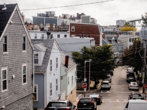
District C11 Dorchester
Dorchester is Boston’s largest neighborhood by area, and District C11 reflects that scale with a wide range of incident profiles across its sub neighborhoods. Aggregate crime rates in C11 are above the city median for violent offenses, but this average masks enormous internal variation. Savin Hill, Pope’s Hill, and the Ashmont corridor have substantially better safety profiles than some of the areas around Columbia Road and Bowdoin Geneva.
Understanding Dorchester requires the same granular approach recommended for Roxbury. The neighborhood’s size means that aggregate statistics are among the least reliable indicators of what life will actually feel like at a specific address. Renters willing to do block level research using BPD incident data will consistently find pockets of Dorchester that outperform the district average by a significant margin.
District D4 South End and Back Bay
District D4 covers the South End, Back Bay, and Fenway. This is one of Boston’s most densely populated and high value rental markets, and the crime profile reflects the dual nature of that density. Property crime rates are among the highest in the city on a per square mile basis, driven by car break ins, bicycle theft, and larceny from retail environments. Violent crime rates are comparatively low.
Are You a Licensed MA Real Estate Agent?
List your Boston rentals and properties free on Homzora. Zero fees. Zero commissions. Direct leads sent to you.
For renters, D4 is generally among the safer choices for personal safety, with the primary concern being property security. The Fenway sub neighborhood within D4 sees elevated incident activity on Red Sox game days and during concert events at Fenway Park, which creates periodic spikes in the data that do not represent baseline conditions.
Districts E5, E13, and E18 West Roxbury, Jamaica Plain, and Hyde Park
The E districts covering West Roxbury, Jamaica Plain, and Hyde Park consistently record the lowest violent crime rates in Boston on a population adjusted basis. District E5, which covers West Roxbury, is routinely among the safest by nearly every metric the BPD tracks. Jamaica Plain, covered by E13, has seen some uptick in property crime in the Centre Street commercial corridor but maintains relatively low violent incident rates. Hyde Park in E18 is consistently low across most offense categories.
These districts are often overlooked by renters focused on proximity to downtown, but the commute tradeoff comes with a meaningful safety premium backed directly by the data. For renters prioritizing safety above all else, the E districts represent the strongest evidence based case in Boston’s rental market.
How to Read BPD Crime Data as a Renter
The BPD’s crime incident data is publicly available and genuinely accessible to anyone willing to spend time with it, but a few interpretive principles will help you avoid the most common mistakes renters make when looking at crime statistics for the first time.
Focus on Offense Categories That Affect Residents
Not all crime categories are equally relevant to renters. Commercial burglary, for instance, has little bearing on your personal safety as a resident. The categories most worth tracking for renters are residential burglary, aggravated assault, robbery, and motor vehicle theft if you own a car. These offense types directly affect the quality and safety of daily residential life. Larceny from person, which covers pickpocketing and similar offenses, is worth noting if you frequently walk through commercial areas.
Look at Trends Not Snapshots
A single year of data tells you very little. The most valuable insight comes from comparing three to five year trends. A neighborhood with elevated incident counts that are declining year over year is a very different risk environment than a neighborhood with lower counts that are rising. Trend direction often matters more than absolute level when you are making a one year or two year rental commitment.
Use Address Level Data When Possible
The BPD geocodes most reported incidents, meaning you can filter the public dataset to incidents within a specific radius of any address. Filtering to a quarter mile radius around a prospective apartment and reviewing the incident log for the past 12 to 24 months gives you a genuinely specific picture that district averages simply cannot provide. This is the single most powerful analytical tool available to renters and it costs nothing except a little time.
Combine Crime Data with Other Indicators
Crime statistics are most powerful when combined with other data sources. School quality metrics, business permitting activity, property value trends, and infrastructure investment signals all help contextualize what the crime data is telling you. A neighborhood with declining crime and rising property values and new business activity is almost certainly on a positive trajectory. Our Boston Housing Data resource brings many of these indicators together in one place, which makes cross referencing considerably easier.
What Crime Data Means for Your Lease and Financial Decisions
Understanding safety data is not just about peace of mind. It has direct implications for financial decisions you make as a renter. Neighborhoods with higher property crime rates may warrant higher renters insurance coverage limits or a different policy type. If you are parking a vehicle on the street, the motor vehicle theft rate in your specific district should inform how much you spend on vehicle security measures.
When you are ready to sign a lease, ensuring the agreement includes appropriate clauses around security deposits, maintenance responsibilities, and habitability standards protects your financial interests regardless of neighborhood. Using a professionally structured LawDepot Lease Agreement ensures that the contract you sign meets Massachusetts legal standards and clearly defines the obligations of both parties. This matters everywhere but it matters especially in competitive rental markets where landlords sometimes rush the paperwork process.
Your credit profile also affects your ability to access rentals in the safest, most competitive neighborhoods. Landlords in lower crime, high demand districts like Back Bay, Beacon Hill, and the E district neighborhoods receive multiple qualified applicants for every available unit. Having a strong, accurate credit report is essential to competing for these apartments successfully. SmartCredit gives renters a detailed view of their credit profile along with tools to identify and address any inaccuracies before they become obstacles during an application process.
For renters moving into older Boston housing stock, which is prevalent across nearly every neighborhood in the city, home systems and appliances can fail unexpectedly regardless of neighborhood safety profile. A Choice Home Warranty plan provides coverage for major systems and appliances that a standard renters insurance policy typically excludes, giving you a financial buffer against the unexpected costs that older housing frequently produces.
Using Safety Data to Narrow Your Neighborhood Search
The practical application of all this data is straightforward once you have decided what you are optimizing for. Renters prioritizing personal safety above price and commute convenience should focus their search in E5, E13, and E18. Renters who prioritize location and walkability and are comfortable with higher property crime exposure should focus on A1 and D4 while taking proactive steps to protect their belongings. Renters seeking a balance of value, improving safety trends, and access to transit should look carefully at A7 and specific sub neighborhoods within C11 and B2.
Our Boston Neighborhood Finder tool is designed to help you filter neighborhoods based on exactly this kind of priority based decision making. It incorporates safety data alongside commute times, rental price ranges, school information, and transit access so you can identify the neighborhoods that match your complete set of priorities rather than optimizing for just one variable at a time.
The Data Driven Renter’s Checklist for 2026
- Identify the BPD district covering any neighborhood you are considering and pull the most recent 24 months of incident data from the City of Boston’s open data portal.
- Filter the data by offense category and focus on residential burglary, aggravated assault, robbery, and motor vehicle theft as your primary indicators.
- Compare incident rates on a population adjusted basis, not raw counts, to make fair comparisons between districts of different sizes.
- Look at three year trends to understand whether the neighborhood’s safety profile is improving, stable, or worsening.
- Use geocoded incident data to analyze a quarter mile radius around any specific address you are seriously considering.
- Cross reference crime data with housing market trends using the Boston Housing Data resource to get a complete picture of neighborhood trajectory.
- Adjust your renters insurance coverage limits and vehicle security practices based on the specific risk profile of your chosen district.
- Ensure your lease agreement is legally sound and protective of your interests before signing anything.
- Prepare your credit profile before applying for rentals in competitive, lower crime districts where landlord selection standards are highest.
Final Thoughts on Safety, Data, and Smart Renting in Boston
Boston’s rental market in 2026 is as competitive and complex as it has ever been. Renters who rely on reputation and anecdote will continue making housing decisions with incomplete and sometimes dangerously inaccurate information. Renters who take the time to engage with the BPD’s publicly available crime data, understand how district statistics translate to neighborhood level realities, and combine that information with housing market trends and financial preparation will consistently make better decisions with more confidence and less regret.
The data does not tell you everything. It cannot capture the feel of a street on a Saturday morning or the quality of your neighbors or the responsiveness of a building’s management. But it provides an objective foundation that no amount of informal research can replicate, and
Stay Ahead of the Boston Market
Monthly insights on Boston rents, home tips, and investment opportunities delivered free to your inbox.
Power Backup for Boston Homeowners
Power your Boston home or rental property with BLUETTI portable power stations. Perfect backup power for New England winters and storm season.
Recommended Furniture for Boston Apartments
Shop Sicotas for nightstands, TV stands, sideboards, and more. Quality furniture at affordable prices with fast delivery to Greater Boston.
Related Boston Housing Resources